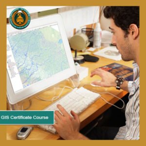
GIS Certificate Course at Trytoon Academy, Bhubaneswar
The GIS Certificate Course at Trytoon Academy, Bhubaneswar is designed for students, professionals, and enthusiasts who want to master Geographic Information Systems and its practical applications. This short term job-oriented course focuses on GIS mapping, spatial data analysis, remote sensing, and geospatial technology. The program equips you with the skills to work in urban planning, environmental management, disaster risk assessment, infrastructure development, and land surveying.
With 1 to 6 months flexible duration, the course is suitable for 10th pass, 12th pass, graduates, and working professionals who wish to enhance their technical skills and improve their employability.
 Why Choose GIS Certificate Course at Trytoon Academy?
-
Government-recognised certificate valid across India.
-
Short term flexible duration – from 1 month to 6 months.
-
Eligibility: 10th, 12th, or graduation in any stream.
-
Placement assistance with industry tie-ups.
-
Hands-on practical training with QGIS and ArcGIS software.
-
Experienced faculty with real-world project experience.
Course Objectives
The primary aim of the GIS Certificate Course is to:
-
Provide a clear understanding of geographic information systems and mapping technologies.
-
Teach students how to collect, process, analyze, and present spatial data.
-
Train students in QGIS, ArcGIS, and remote sensing tools.
-
Prepare learners for real-world GIS projects in government and private sectors.
What You Will Learn
During the GIS Certificate Course, students will gain expertise in:
-
Introduction to Geographic Information Systems (GIS) – Understanding the concepts and components.
-
Cartography and Map Design – Creating professional maps for analysis and reporting.
-
Data Collection and Management – Using GPS devices and satellite imagery.
-
Spatial Data Analysis – Performing overlay analysis, buffering, and geostatistical operations.
-
Remote Sensing Basics – Working with satellite images and aerial photography.
-
QGIS and ArcGIS Training – Learning industry-standard GIS software for mapping and analysis.
-
Applications of GIS – Urban planning, environmental studies, land use planning, and transportation analysis.
-
Project Work – Real-life GIS projects for practical exposure.
Course Duration & Eligibility
-
Duration: 1 month to 6 months (flexible based on specialization).
-
Eligibility: 10th pass, 12th pass, or graduates from any field.
-
Mode of Learning: Classroom + Practical Labs + Fieldwork.
Specialisations Available
Students can choose from different short term GIS specialisations:
-
GIS Basics & Mapping – 1 Month
-
QGIS Fundamentals – 2 Months
-
ArcGIS Professional Training – 3 Months
-
Spatial Data Analysis Techniques – 4 Months
-
Remote Sensing Applications – 5 Months
-
Complete GIS Professional Program – 6 Months
Career Opportunities after GIS Certificate Course
After completing the GIS Certificate Course, you can work in:
-
Urban and Regional Planning
-
Environmental Management
-
Disaster Risk Management
-
Land Surveying and Mapping
-
Infrastructure Development Projects
-
Agricultural Planning and Forestry
-
Transportation Planning
Job Roles:
-
GIS Analyst
-
Cartographer
-
Remote Sensing Specialist
-
Urban Planning Assistant
-
GIS Data Manager
-
Surveyor
Benefits of Studying GIS at Trytoon Academy
-
Practical learning approach with hands-on projects.
-
State-of-the-art labs equipped with GIS software.
-
Experienced trainers from the industry.
-
Portfolio development for career growth.
-
Placement guidance and interview preparation.
Why GIS Skills Are in Demand
In today’s data-driven world, GIS professionals are in high demand across government, corporate, and non-profit sectors. GIS technology is essential for smart city planning, environmental conservation, resource management, and disaster preparedness. With digital mapping and spatial analysis skills, you can work in urban development, transportation, energy, telecom, and environmental research.
How to Apply for GIS Certificate Course at Trytoon Academy
-
Select your preferred specialization and duration.
-
Check eligibility based on your academic background.
-
Fill out the online application form on Trytoon Academy’s official website.
-
Attend counseling to understand the course structure.
-
Complete enrollment and start your training.
Conclusion
The GIS Certificate Course at Trytoon Academy, Bhubaneswar is your gateway to a career in geospatial technology and mapping solutions. With short-term flexible learning, practical training, and placement support, this course prepares you for high-demand GIS careers in multiple industries. Join now and gain the expertise to turn spatial data into impactful solutions.
